Hiking to Dawson Falls, Taranaki
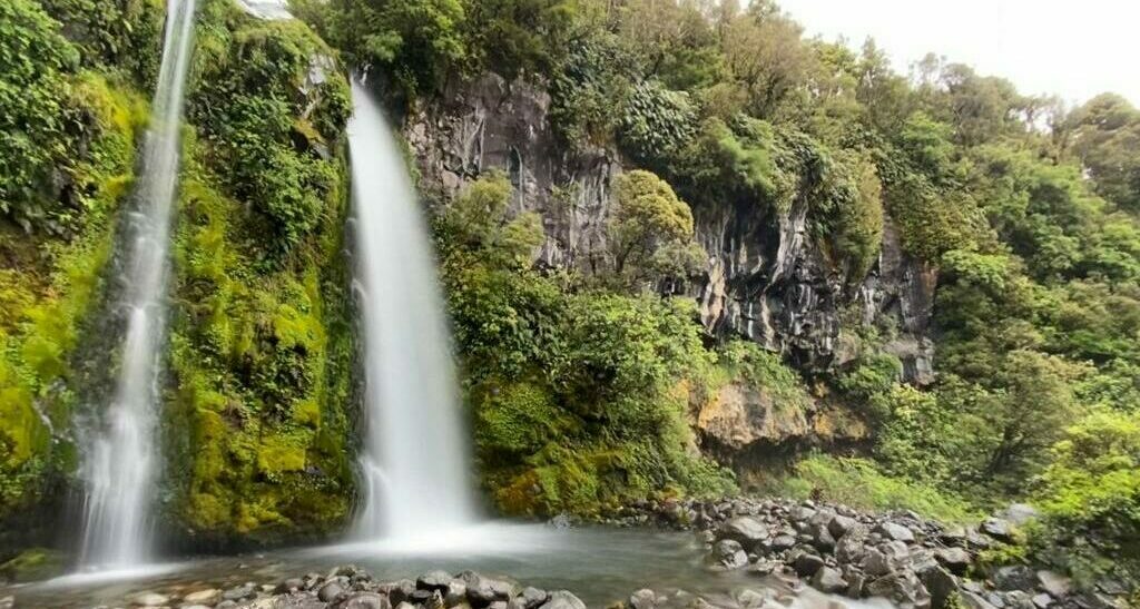
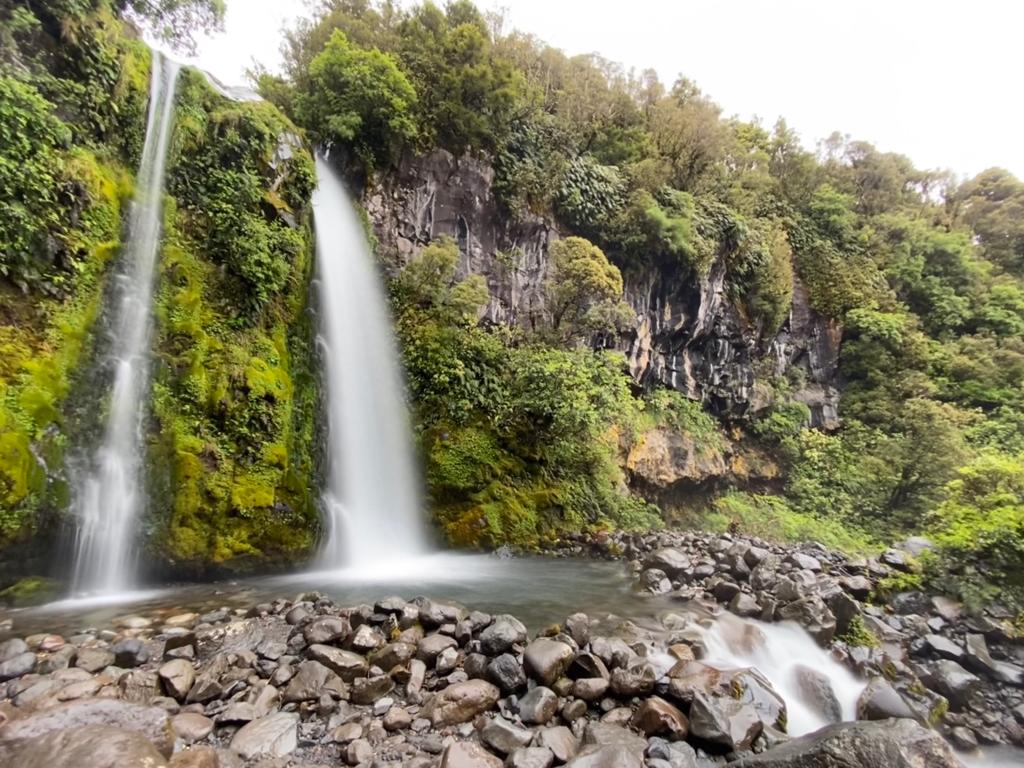
Dawson Falls is an 18m high waterfall on the Kapuni Loop track. The Kapuni Loop track is located on the south-eastern side of Mt. Taranaki, not far from Stratford and Eltham. The trailhead starts at the Dawson Falls Visitors Centre so this is where you want to start your walk.
In Māori, Dawson Falls is known as Te Rere-o-Noke or ‘the falls of Noke.’ The waterfall was named after Noke, a character in early Māori lore, who escaped his pursuers by hiding behind the falls.
The falls take their English name from Thomas Dawson, an early European arrival, who settled in Manaia in the job of postmaster in 1881. He learned of the falls existence 2 years later and it quickly became a tourist attraction. Mr. Dawson would later drown in a boating accident on the Whanganui River in 1899.
How Do I Get To Dawson Falls in Taranaki?
If you’re coming from New Plymouth, take SH3 south to Stratford. Then take Opunake Road through Cardiff to Mahoe. Or you can take Monmouth Road through Pembroke to Cardiff Road to skirt around Stratford altogether. You’ll link up with Opunake Road in Cardiff itself, so just turn west at Cardiff onto Opunake Road and you’re be right on track.
Once you’ve passed through Mahoe, make a right turn onto Manaia Road and follow this up onto the mountain.
Manaia Road terminates at the Dawson Falls Visitor Centre.
How Long Does It Take To Get To Dawson Falls Visitors Centre
By Car:
- From New Plymouth – 1 hour
- From Stratford – 30 minutes
- From Kaponga – 17 minutes
Dawson Falls Visitors Centre & Carpark
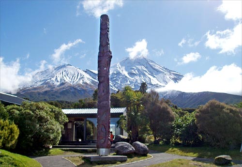
The Dawson Falls Visitors Centre is located at the terminus of Manaia Road, on the south-eastern side of Mt. Taranaki. There’s a carpark here, and a toilet block. The Visitors Centre is over 900m above sea level. Head inside and have a look at the replica of Syme Hut, it’s very cool. There is also a great model diagram of Mt Taranaki which will really help cement the picture in your mind of where you are in relation to the mountain and where you’ll be going!
Note that the Visitors Centre is not open 7 days a week. It is open from Thursday to Sunday from 9am to 3.30pm. If you’re planning to start or finish walking outside of these hours or days of the week make sure you have shared your plans with someone at home. Let them know what time you plan to be back and what to do if they don’t hear from you.
The public toilets at the Dawson Falls Visitor Centre carpark are open 24 hours – even if the Visitors Centre is closed.
There is no food or coffee service available at the Dawson Falls Visitor Centre, there are no shops nearby. Your nearest service town for food supplies would be back in Stratford. Make sure you take enough food and water for everyone on your trip, plus a little extra as a back-up in case your day doesn’t go to plan.
The Kapuni Loop Track, Egmont National Park/Te Papakura-o-Taranaki
Distance: 1.4km
Allow: Roughly 60 mins, plus a decent stop to look at the Dawson Falls Power Station building
(You’ll probably hear many people refer to this track as the Dawson Falls track, but it’s official name is the Kapuni Loop – it just happens to be the track that takes you to the geological feature that is the Dawson Falls waterfall itself)
The Kapuni Loop track forms a nice loop that sits below the Visitors Centre. You can complete the loop either clock-wise or anti-clockwise, whichever suits you best.
We completed the loop track in a clock-wise direction. We wanted to see the Dawson Falls Power Station first.
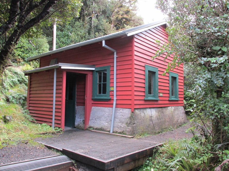
Dawson Falls Power Station
Distance: 100m return (50 metres from turn off to the Power Station, and 50 metres back the same way to the main trail)
Allow: 20 minutes return (10 minutes walk in, 10 minutes walk out again)
This is a great little side trail on the way to Dawson Falls, it’s well worth doing. When the Dawson Falls Lodge (now called the Dawson Falls Mountain Lodge) was built in 1896 it required a power source to service large numbers of guests. The nearest power supply was in Kaponga, 12kms away, which was unfeasible in those days. So, they built their own power station up on the mountain, using the Kapuni Stream for hydroelectric power generation.
Eventually the Lodge connected to the national power grid in the 1980’s, but the power station was kept operational to supply small amounts of power for various purposes.
The Dawson Falls Power Station is now the oldest, continuosly operating power generation system in New Zealand. It is currently producing only 40% of it’s total capacity, which has probably helped the longevity of the system.
From the Power Station to Dawson Falls
Once you’ve passed the power station side trail, you’ll carry on down hill following the Kapuni Stream to the top of Dawson Falls. A timber staircase takes you down to the boulder-ringed pool at the bottom, giving you a great vantage point to view the falls at it’s full height.
There is an excellent lookout
From the Falls, the track crosses over Manaia Road and heads back up towards the Dawson Falls Visitors Centre.
Can I Take My Campervan Up Manaia Road?
Manaia Road is steep and winding, but the bitumen surfacing is in good condition. It is possible to drive campervans up Manaia Road, but drive sensibly and remain considerate towards other road users. Keep to the left for oncoming traffic. Manaia Road is not wide and there is not often a large roadside berm or shoulder, so pulling over to let traffic pass is difficult.
In some areas, the forest grows right up close to the road and if it’s been a long time since a tree-trimmer has been through you might find low-hanging branches are within striking range for larger vehicles.
Which Tracks Start At The Dawson Falls Visitors Centre?
You might be wondering what tracks begin at the Dawson Falls Visitors Centre. By parking at the Dawson Falls Visitors Centre carpark you’ll have access to these trailheads:
- Around the Mountain Circuit
- Lake Dive Hut Track
- Dawson Falls Track
- Waingongoro Hut Track
- Stratford plateau tracks
- Fanthams Peak Track / Panitahi
- Syme Hut Track
Which Maps Do I Follow For The East Egmont Area?
If you arrive when the Visitors Centre is open, you’ll be able to view their interpretation boards and maps inside. These maps are not intended to be used for navigation though, they’re simply a general guide to help you orient yourself in a general sense. For better map detail, use Egmont National Park Map 273-09 or the NZTopo50 map app on your mobile device.
THINGS TO NOTE:
- Remember that Te Papakura-o-Taranaki/Egmont National Park does not allow dogs (or cats) entry into the park – not even in your vehicle. Leave your animals at home.
- Dawson Falls Lodge & Café is currently closed.
To experience the hiking trails of Taranaki with a guided group, join Walking Legends. We offer a 4-day, lodge-based guided Taranaki hike – the Taranaki Discovery Tour. See our calendar of scheduled departure dates on Our Walk Calendar.
For more great walks in Taranaki, check out the Pouakai Crossing. Follow our step-by-step guide to the Pouakai Crossing to plan your trip.
For more information, contact our friendly team.
NZ Freephone 0800 925 569
AUS Freephone 1800 646 584
International 0064 7 533 3157
Or email [email protected]