- 6 May
- written by Cathy Taylor
Step By Step Guide to the Pouakai Crossing
Step-By-Step Guide to the Pouakai Crossing
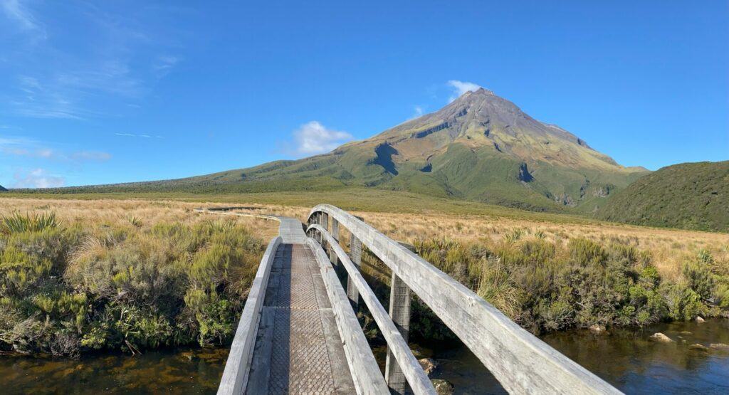
The Pouakai Crossing, sometimes also called the Taranaki Crossing, is New Zealand’s newest day-walk. Located on the north-eastern slopes of Taranaki maunga (mountain) on the western coast of the North Island of New Zealand. This is a must-do track for hikers and visitors to New Zealand!
The track is managed by the Department of Conservation in conjunction with local iwi and environmental conservation groups.
What’s the Difference Between the Pouakai Crossing and the Pouakai Circuit?
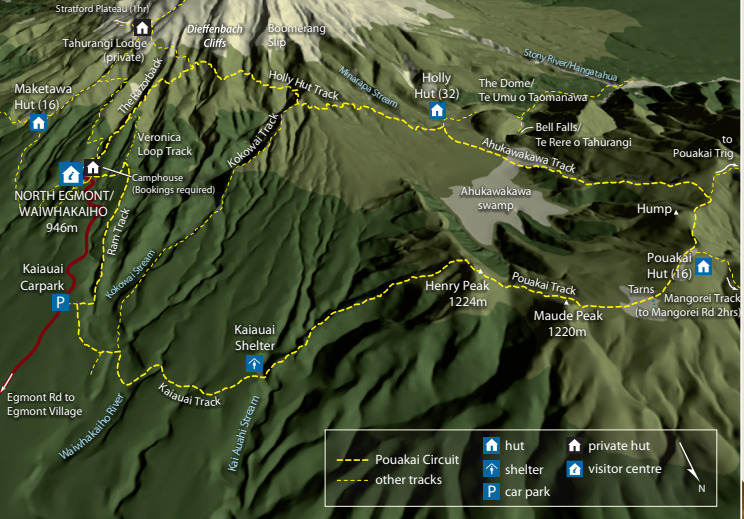
The Pouakai Crossing is a 19km day-walk. Pouakai Circuit is a 25km loop track completed over 2 to 3 days. The Pouakai Circuit starts and ends at the North Egmont Visitors Centre. Most walkers begin at the North Egmont Visitors Centre and walk in a clockwise direction.
The Crossing and the Circuit share much of the same trail. When hikers reach the Pouakai Hut, Circuit walkers carry on east past Maude Peak and Henry Peak back to the Visitors Centre, while the Crossing day-walkers head north down to Mangorei Road.
The length of these two walks is much the same. If you’re walking the Circuit take your time and spend 1 if not 2 nights on the mountain staying in Department of Conservation backcountry huts.
What Does It Cost?
There is no charge to walk the Pouakai Crossing. Unlike the Tongariro Alpine Crossing, you don’t need to make a booking or register to access the track. It is a public walking track. It doesn’t hurt to call into the North Egmont Visitors Centre and make yourself known to the friendly, knowledgeable staff on duty. They’re always happy to help answer your questions or give you an update on weather conditions.
If you’re planning to stay overnight at any of the huts on the mountain, there could be a fee required for accommodation and booking in advance is essential. Check the Department of Conservation online hut booking system to find the hut you want to stay at and check if there are bunks available to book on your chosen dates. The two huts you’ll pass by on the Pouakai Crossing are Holly Hut and Pouakai Hut.
NOTE: Places names in the Egmont National Park are due to change soon as they revert back to their indigenous Māori names. For example, Egmont National Park is now known as Te Papakura-o-Taranaki and Fantham’s Peak is now Panitahi.
How Long Is The Track?
The Pouakai Crossing is 19km long.
What Is The Elevation Gain On The Pouakai Crossing?

This profile doesn’t represent the outline of Mt. Taranaki itself, simply the route that the Pouakai Crossing track takes across the mountain. The far left of the profile represents the start of the track at the North Egmont Visitors Centre, and the far right, the Mangorei Road trailend.
You’ll see that the track begins between roughly 800m – 900m above sea level, it climbs to a height of just below 1,400m. That’s an elevation gain of around 500m – 600m over the course of it’s 19km length. These figures tend to vary depending on by what method you choose to measure it – we’ve had wildly different readings! So treat this as a guide only.
When Is The Best Time To Walk The Pouakai Crossing?
The best time to walk the Pouakai Crossing is in the New Zealand summer hiking season which runs from November through to the end of April. In early November, even though it is springtime, there can be patches of snow and ice on the track. It’s best to plan around the weather and go during a period of warm, sunny spring weather.
During the Christmas holiday period from late December to mid-January you’ll encounter plenty of other hikers, families and day-trippers. By the end of January most families are back home preparing for the school year to start in the first week of February.
The hottest months of the New Zealand summer are February and March. As a result these two months are also busy, particularly on the weekends. You’d do yourself a favour if you’re flexible enough to go mid-week during this time.
If it were us, we’d be looking at going in either early December, late January or mid-March through to mid-April.
Be aware that this is an extreme alpine environment and bad weather can come through at any time, with little warning. Keep an eye on the weather in the days before you plan to go and assess the risks sensibly. If you have to put your plans off by a day or two there is plenty to see and do in New Plymouth township. You’ll be able to entertain yourself while you’re waiting.
Where To Start The Pouakai Crossing?
If we imagined a clock face, the track would run roughly from 4 o’clock to 1 o’clock. The Pouakai Crossing is an end-to-end track, so you can either start at Mangorei Road in the north-east, or at the Egmont Visitors Centre in the south-east. Mangorei Road is a short 11 minute drive from the centre of New Plymouth township, compared to a 30 minute drive from the town centre to North Egmont Visitors Centre.
Many urbanites and casual day-trippers park at Mangorei Road and only walk up/in as far as the Pouakai Tarns then turn around. This is a really easy option if you can’t be faffed organising shuttle transport or you’re really just not that into walking all day. We love walking so we much prefer starting at the Visitors Centre and finishing up at Mangorei Road end.
Transport
There are a couple of shuttle companies in New Plymouth to help transport you to the start or end of the track. We recommend:
- Taranaki Mountain Shuttle – Pouakai Crossing transport
- Ducks & Drakes – Pouakai Crossing transport operator
Self-drivers / Rental Cars
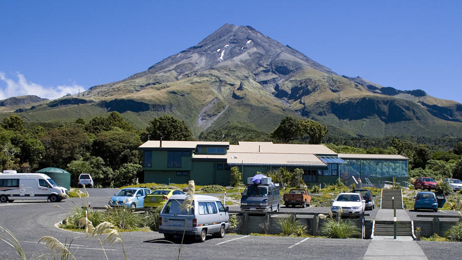
If you’re driving in a private vehicle or you have a rental car you’ll find parking areas at both ends. The North Egmont Visitors Centre carpark gets really busy during the peak of summer between 23rd December and 16th January. When it’s full the carpark will be closed and drivers will be asked to park at the bottom of the mountain access road and take one of the provided shuttles up to the Visitors Centre.
For more information about parking contact the North Egmont Visitors Centre directly.
Toilets
There are basic bathrooms provided at both the North Egmont Visitors Centre and at the Mangorei Road trail end carpark. If you need to go to the bathroom while on the track, we strongly encourage you to follow the seven ‘Leave No Trace’ principles.
What Will You See On The Track?
North Egmont Visitors Centre to Dieffenbach Cliffs
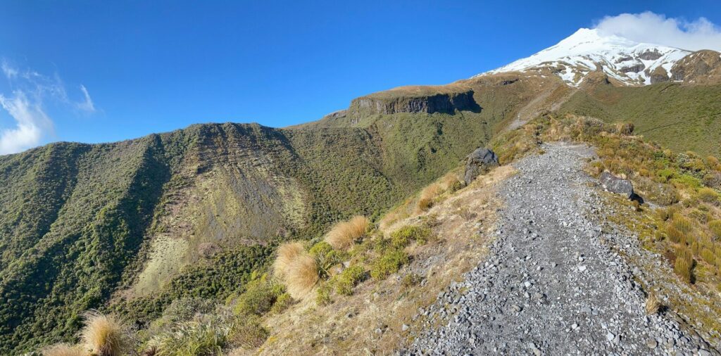
The name of the trail you want is the Holly Hut Track, the signs don’t say ‘Pouakai Crossing.’ The Holly Hut track trailhead begins behind the North Egmont Visitors Centre. From this point the track heads steadily up a formation called Razorback. We’ll make a short, sharp elevation gain at the start of the walk, but once we’re up onto the shoulders of the mountain we turn northwards and things level off nicely after that.
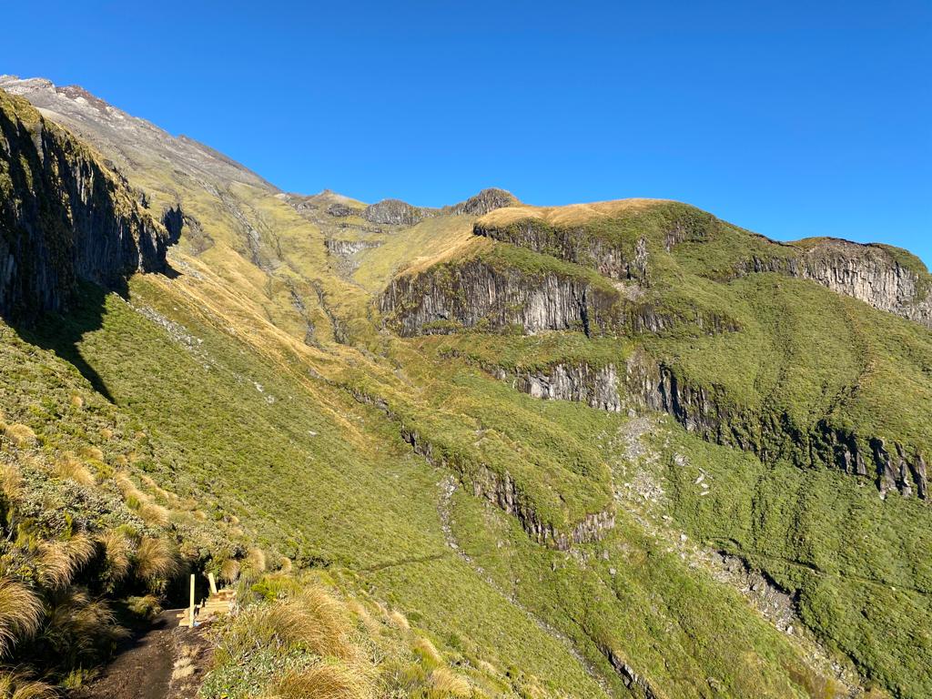
Dieffenbach Cliffs is a beautiful natural geological formation made by a combination of ancient volcanic activity and erosion by wind and rain. They’re named after Ernst Dieffenbach an early ethnologist and explorer in New Zealand’s history. He was the first European man to hike up to the summit of Taranaki maunga in 1839.
Dieffenbach Cliffs to Holly Hut
From the Cliffs the track winds it’s way around a network of headlands and valleys that radiate out like bike spokes from the centre of the mountain. The track maintains relatively level elevation along this section, just gentle undulations.
Boomerang Slip
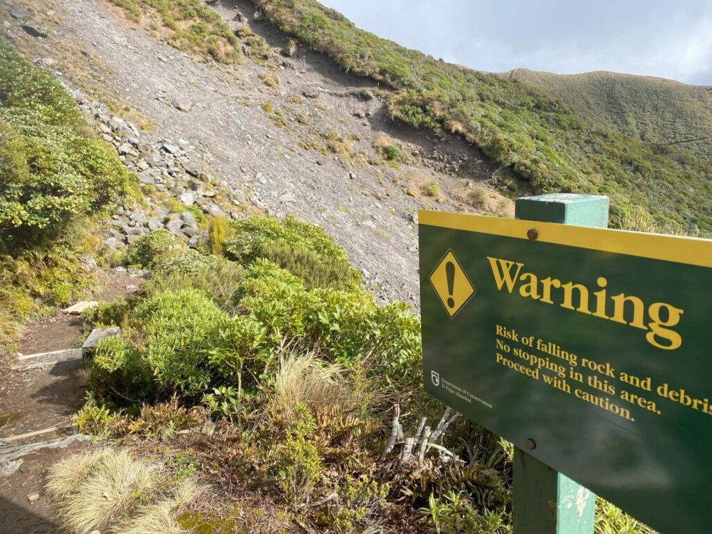
Boomerang Slip is a very short section of trail with loose shale-like rock fragments. We estimated its width to be around 20 metres. The loose material isn’t in active movement, it’s not rolling down the hillside, it’s simply an area where the trail is not wide or well-formed. If you’re not good with heights or suffer from vertigo you’ll be fine if you keep your sights firmly ahead of you. Don’t be tempted to look down the valley until you’re on the other side.
Holly Hut
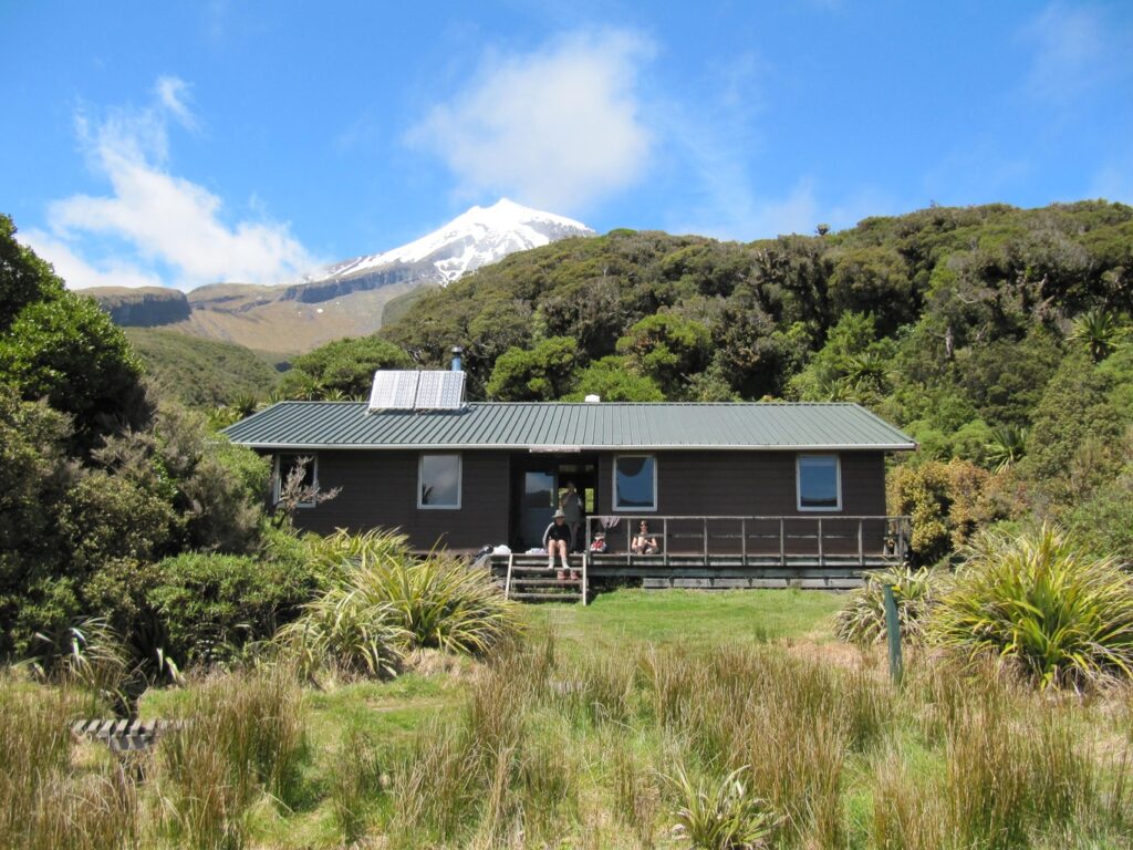
Once you’ve completed the minor descent down off the slopes of Taranaki you’ll approach the turn off to Holly Hut on the left hand side of the track. Holly Hut is roughly a 5 to 10 minute walk from the track junction.
Bells Falls
If you’d like to get to Bells Falls, take the Bells Falls track towards Holly Hut to get around a hillock called The Dome and onto the Falls themselves. This option takes around 60 minutes return.
If you don’t turn off to Holly Hut you’ll carry on north towards the Ahukawakawa Swamp. At the Holly Hut track junction the track name changes from Holly Hut Track to the Ahukawakawa Track.
Ahukawakawa Swamp
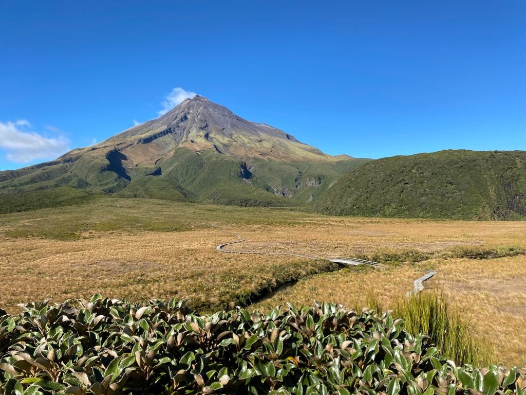
The Ahukawakawa Swamp bridges the gap between the side of Taranaki maunga and its’ next door neighbour, the Pouakai Ranges. Ahuakawakawa is actually a wetland and catches all the water running off both the Pouakai Ranges and Taranaki. Then the water sends off over Bells Falls and down the Hangatahua River. It’s a unique and fragile wetland full of rare, precious alpine plant species, some of which don’t exist anywhere else in New Zealand. This is also where our large, blue, carnivorous snail lives – the Powelliphanta. You won’t see them during the day, they’re nocturnal, but you might see a snail shell if you’ve got keen vision.
The track levels out beautifully across the wetland, giving any tired legs a welcome break. You won’t get wet feet because the trail is formed by timber boardwalks that elevate you above the wetland to reduce any environmental impacts from foot traffic.
If you like to walk with hiking poles you need to know that the design of these boardwalks is not the friendliest for poles. The distance between each board is such that it likes to snaggle poles.
Ahukawakawa Swamp to Pouakai Hut & the Pouakai Tarns
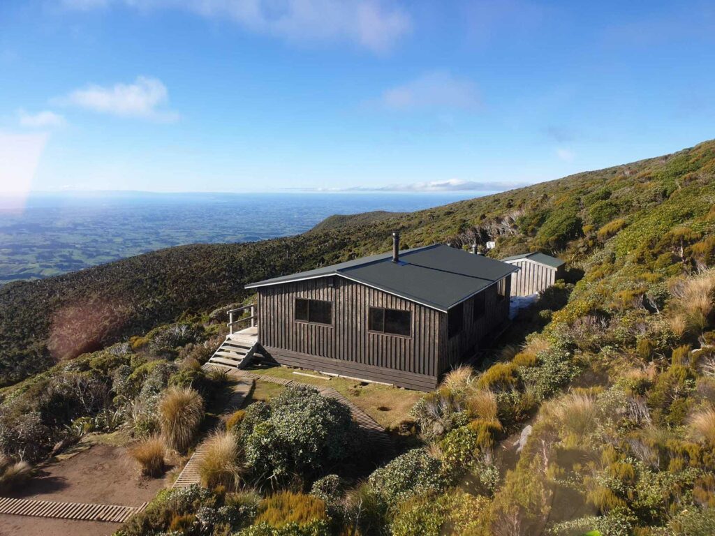
Once you’ve crossed the wetland you’ll make the second ascent of the day. The track climbs straight up the ridgeback and onto the Pouakai Range. At the top of the incline you’ll meet up with the Pouakai Track which runs east to west. You’re going to turn right and head east for a little while until you see the Pouakai Hut come up on your left.
Another track junction will invite you to either continue east to the Pouakai Tarns or turn north towards the Mangorei Road exit.
The Pouakai Hut is another bookable DOC hut for an overnight stay. Bookings are essential.
NOTE: The Pouakai Hut will be closed for redevelopment in February 2024. Bookings for overnight accommodation will only be available up to February 2024.
Pouakai Tarns
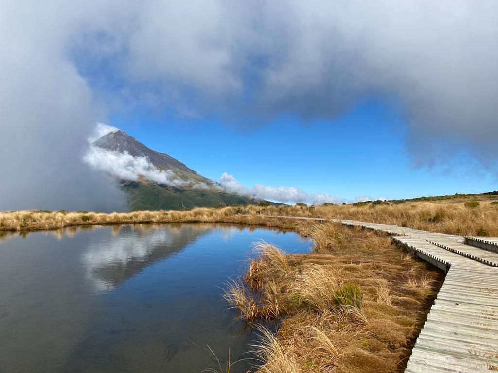
The Pouakai Tarns is roughly 15 – 20 minutes walk from the Pouakai Hut and well worth a trip! These tarns, although small, are perfectly situated to reflect Taranaki’s peak in the still waters. Therefore they carry significant social media fame so expect to pass lots of urbanites on their way up to capture ‘the shot’.
You’ll need clear weather to have any hope of capturing a reflection so that’s all the more reason to plan your trip around the weather!
Pouakai Tarns to Mangorei Road
Once you’ve snapped enough shots of the Tarns you’ll turn around and double back to Pouakai Hut. This hut is able to be booked for overnights stays, take a look at the Department of Conservation online hut booking system. It’s not a big hut, but it has water and long-drop/pit-style toilet facilities if you need to use them.
From Pouakai Hut it’s a long steady descent down to Mangorei Road. Some walkers find this the hardest part of the day. Perhaps because we’re aware that we’ve seen all the highlights for the day. Now’s the time to start looking forward to the cool beverage and delicious snacks waiting for you back down on the lowlands!
Guided Walk on the Pouakai Crossing
If you’d like to do this walk with the safety and support of a group, check out our holidays for hikers at Walking Legends. We’ve got a 4-day Taranaki Discovery Tour that runs regularly throughout the New Zealand summer hiking season. We’ll do the Pouakai Crossing on Day 2 (or Day 3 if the weather dictates it) of this itinerary. On the intervening days we’ll show you some other phenomenal hiking tracks the Taranaki region has to offer.
Departing from and returning to Rotorua, this all-inclusive package covers transport, meals, accommodation, on-trail professional guides. We also include complimentary hire of backpacks, raincoats or walking poles.
After spending the days in the fresh air on invigorating walking and hiking tracks, you’ll relax for 3 nights in ensuite accommodation in the peaceful greenbelt of New Plymouth. This is a fully catered tour so you’ll enjoy 3 fresh, nutritious meals a day paired with local wines.
For more information check out this walk page on our website ‘Taranaki Discovery Tour’ or have a chat to our friendly team on:
Email: [email protected]
Phone:
- International: 0064 7 533 3157
- New Zealand Freephone: 0800 925 569 (WALK NZ)
- Australian Freephone: 1800 646 584